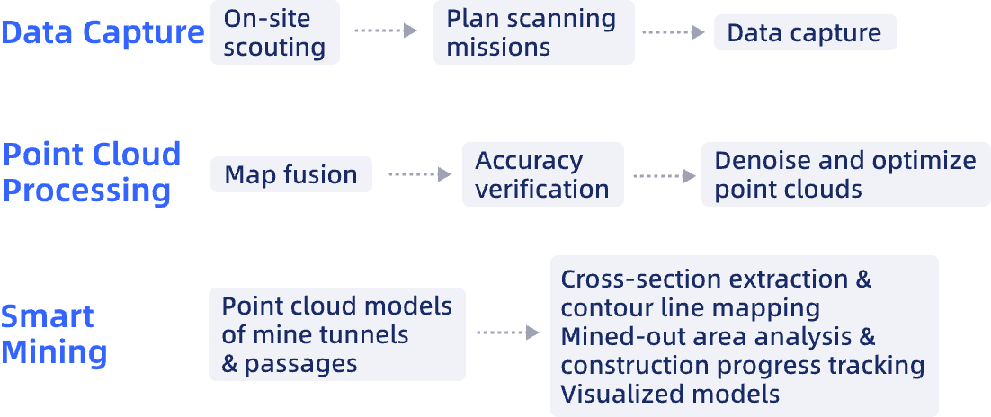
Replace slow, labor-intensive manual surveys with rapid, automated data capture, significantly reducing time spent in large mining areas and simplifying complex data processing.
Overcome accuracy limitations caused by environmental factors like dust and vibration, which often lead to accumulated errors in traditional surveying methods.
Generate comprehensive 3D models that provide a complete visualization of the mine, addressing the limitations of single-perspective data and enabling accurate measurement of hidden or complex areas.
Remove personnel from hazardous survey environments, such as high slopes and mined-out areas, mitigating risks associated with geological hazards and equipment failures.
Enable real-time monitoring of dynamic mine changes, providing up-to-date data for timely and informed decision-making, which is lacking in traditional, static survey approaches.