Capture complete filming locations with accurate measurements and photorealistic colors. Transform physical spaces into production-ready 3D assets that your entire team can access instantly.
Application Scenarios
Location Documentation: Skip multiple tech scouts. Create comprehensive digital doubles your team can explore remotely, complete with measurements and annotations that production designers need.
Virtual Camera Planning: Pre-visualize shots before arriving on set. Test camera positions, lens choices, and blocking in real locations without expensive crew days.
Set Design Planning: Extract exact dimensions from any space. Eliminate costly errors from manual measurements that lead to set pieces that don’t fit on location.
Visualization Integration: Send scan data directly to Unreal Engine or Unity. Blend real locations with virtual elements for accurate previs your directors can trust.
Challenges Addressed
Incomplete Location Data: Stop discovering critical location issues during production. Capture every spatial detail during scouts, including ceiling heights and column placements that flat photos miss.
Distributed Teams: Give remote departments the same spatial understanding as those who visited locations. Make critical decisions faster with shared 3D references.
VFX Coordination: Deliver accurate scene data to VFX teams immediately. Reduce expensive plate photography and reshoot requests with comprehensive location geometry.
Budget Pressure: Cut location prep time and spending. Decrease crew size needed for technical scouts while improving the quality of pre-production decisions.
The XGRIDS Advantage
Precision & Realism
Capture centimeter-accurate, photorealistic digital environments with the precision of LiDAR and the visual fidelity of 3D Gaussian Splatting.
Capture Large-scale Environments
Rapidly capture vast locations, from warehouse-sized soundstages to outdoor urban locations, outperforming visual-only scanning in speed and scope.
Seamless Virtual Production Integration
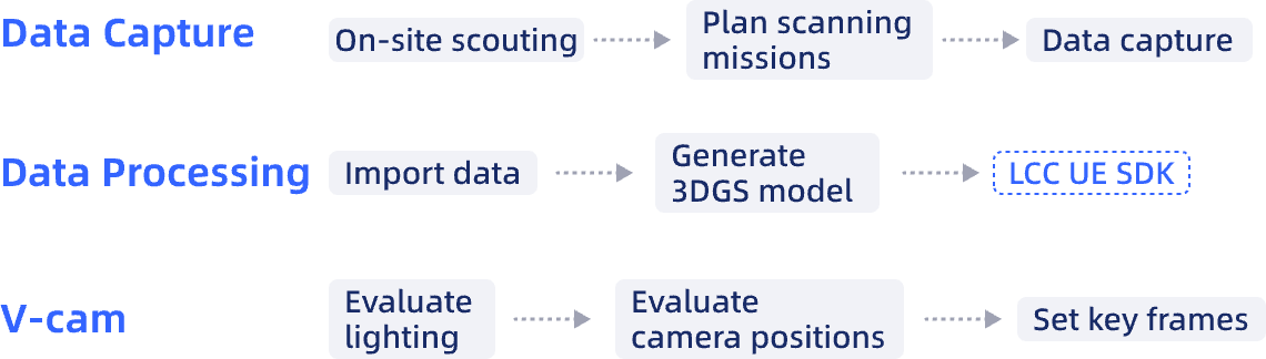
Direct data import to Unreal Engine through Lixel CyberColor SDK creates a continuous workflow from location capture to virtual production. Eliminates conversion bottlenecks that delay visualization.
Hardware
Lixel L Series
High-Precision 3D Scanner
Lixel K Series
Compact 3D Scanner
Software
Lixel CyberColor
Next-Gen 3D Content Format
Workflow
Case Studies
XGRIDS PortalCam Becomes Only Product to Win Four Categories at 2026 NAB Show Product of the Year Awards
3D Gaussian Splatting Applied in Scouting and Pre-Production
Chasing Dragons in Iceland - How Mobile Virtual Production Conquered the Impossible