Integrating LiDAR technology with visual data processing for high-precision digital terrain mapping in challenging environments.
Application Scenarios
Restricted and Height-Limited Zones Efficiently and safely capture terrain and feature data when drones are grounded, e.g. no-fly zones (military, airports) and areas with height restrictions (dense urban environments, under bridges).
Complex Terrain and Confined Spaces Accurately survey challenging environments like dense residential areas, narrow streets, and alleys with flexible and adaptable technology.
Privacy-Sensitive Areas Conduct rapid topographic surveys in residential and commercial areas while minimizing privacy concerns posed by drone flights through unintrusive data capture methods.
Application Scenarios
Restricted and Height-Limited Zones Efficiently and safely capture terrain and feature data when drones are grounded, e.g. no-fly zones (military, airports) and areas with height restrictions (dense urban environments, under bridges).
Complex Terrain and Confined Spaces Accurately survey challenging environments like dense residential areas, narrow streets, and alleys with flexible and adaptable technology.
Privacy-Sensitive Areas Conduct rapid topographic surveys in residential and commercial areas while minimizing privacy concerns posed by drone flights through unintrusive data capture methods.
The XGRIDS Advantage
Efficiency
Achieve 5 to 8 times faster data collection with a portable, single-operator system, even in complex environments.
Ease of Use
Capture real-time, true-color point clouds with “what you see is what you get” accuracy, powered by advanced Multi-SLAM for precise point cloud colorization.
Quick Data Processing
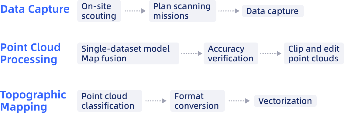
Efficient data processing through map fusion and concurrent dataset processing, yielding quick maps/profiles and easy AutoCAD integration via RCP export.
Actionable 3D Data
Integrate and reuse rich 3D models with clear textures and accurate real-world representation.
Hardware
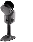
Lixel L Series
High-Precision 3D Scanner
Lixel L Series
High-Precision 3D Scanner
Software
LixelStudio
Point Cloud Studio
Workflow
Case Studies
Handheld SLAM vs. TLS for Highway Bridge Surveys, A Comparison Study
Handheld SLAM vs. TLS for Highway Bridge Surveys, A Comparison Study
Handheld SLAM vs. TLS for Highway Bridge Surveys, A Comparison Study