







Field-Ready in Minutes

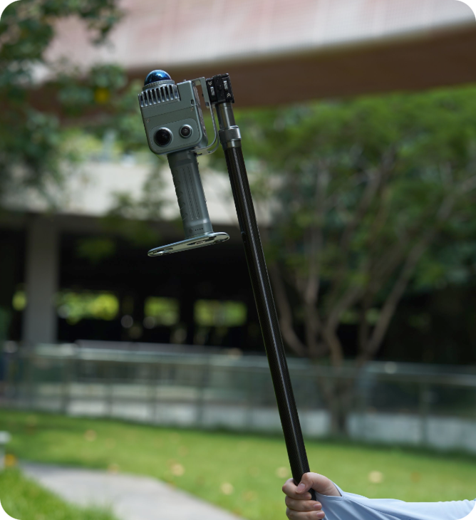
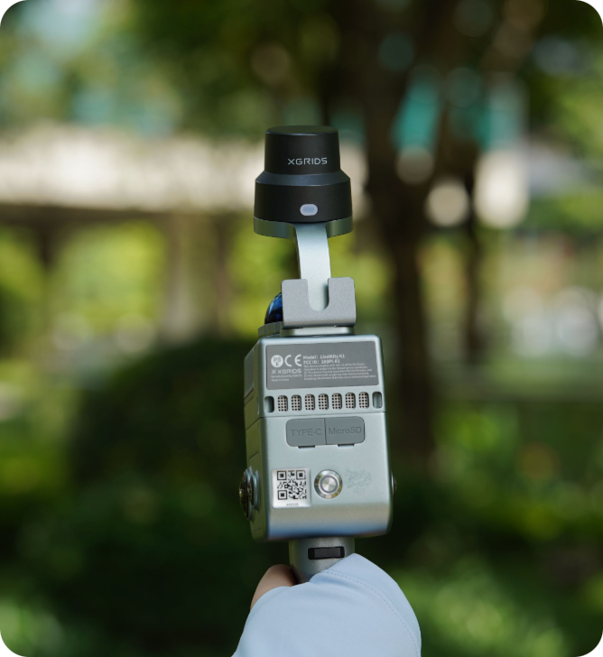
Compact Handheld 3D Scanner

Compact, powerful, and precise.

Generate rich-colored, finely

detailed 3D models with

unmatched ease and speed.

Why K1 Outperforms Traditional Methods

Tripod-based scanning requires days on-site, expensive specialists, and weeks of post-processing. Projects stall waiting for deliverables.

5+ Days→Few Hours

Real-time colored models eliminate post-processing delays

Heavy Setups→Walk

<1kg handheld operation, no tripods or specialists

Professional Results

±1.2cm accuracy at 1/3 the equipment cost

Instant Decisions

Review results on-site, eliminate return visits

Specs that Devlier on the Promise

Multi-SLAM algorithms ensure reliable capture in challenging environments.
48MP panoramic cameras capture rich color data while 360° LiDAR provides
comprehensive spatial coverage at 200,000 pt/s. IP54 rating handles
real-world conditions.

±1.2cm Accuracy

200,000 points/sec

40m Range

1.5hr Battery

48MP Panoramic Cameras

<1kg Weight

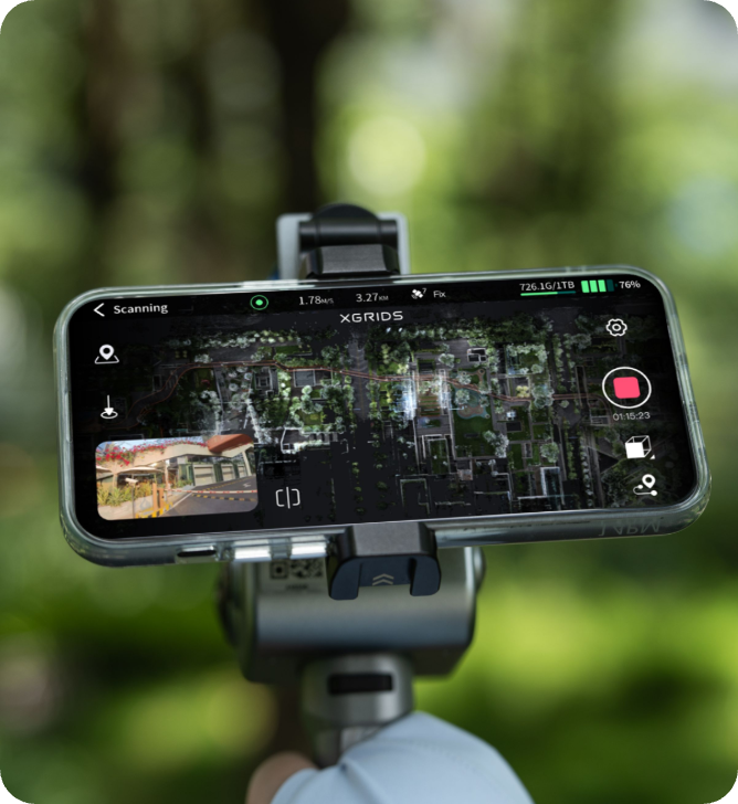
Walk and capture with one-button operation. Use LixelGO - the companion mobile app for real-time scanner control, mission planning, and field monitoring.

"97% Faster Than Traditional Scanning Methods"

“The XGRIDS K1 transformed our preconstruction process. What used to take 5+ days with tripod scanning now takes just hours. We reduced our scanning time from 8 hours to 17 minutes per floor – that’s a 97% time savings. The point cloud quality meets all our architectural modeling requirements, and the automated processing eliminates manual intensive work.
That level of increased efficiency means getting the data to the right people quicker and making decisions quicker. And time is money!”
— Ben Stocker, Senior Construction Technologist, Skender

"Preserving Nature in Remote Environments"

“In areas without cell coverage, the XGRIDS system enables autonomous scanning with minimal setup—just a button press to begin capturing 3D data while moving through the landscape. The equipment is lightweight and durable enough for remote environments, fitting in a backpack and suitable for navigating rugged terrain efficiently.
The true advantage of using 3DGS technology lies in its ability to capture the complexity of vegetation with remarkable detail—while keeping the final file size manageable. What matters most is achieving a clear, accurate visualization of the landscape in a format I can easily render on screen, share online, or even experience through a VR headset.”
— Carlos Bausa Martinez, Founder of ArquiaVis

Complete Solution, Maximum Flexibility

Extension Pole

Phone mount

Software

Professional point cloud processing with measurement, editing, and CAD export tools

AI-powered photorealistic 3DGS model generation with 90% file size reduction

Industries

Architecture & Construction: Interior documentation, as-built surveys, progress monitoring, BIM integration

Infrastructure & Resources: Volume calculation, mining surveys, facility documentation

Real Estate & Property: Property assessment, renovation planning, digital twin

Cultural Heritage: Artifact preservation, museum digitization, historical documentation

Environmental Conservation: Ecosystem monitoring, climate impact studies, habitat preservation